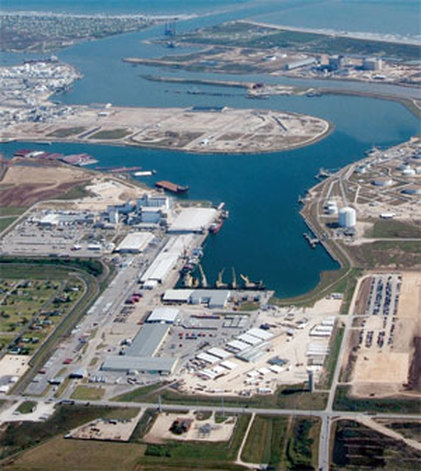
U-SURGE
  • Home
  • About
  • U.S. Cities
    • U.S. Gulf Coast >
      • Mandeville
    • Florida >
      • Palm Beach >
        • Articles
  • Products
    • Recent Hurricane Data >
      • 2016
      • 2017 >
        • TS Cindy
        • Hurricane Harvey
        • Hurricane Irma
        • Hurricane Nate
      • 2018 >
        • TS Alberto
        • TS Gordon
    • Storm Surge Mapping
    • Real Estate
  • Contact

Freeport

Picture

Data Sources

Current Tide Gauge
TIDE GAUGE DATA FROM NOAA TIDES AND CURRENTS

​Operation: National Ocean Service (NOS)
Coordinates: Lat: 28.9433, Lon: -95.3017

6-min Water Level Data
Sep 28, 2006 - Present

Hourly Water Level Data
Sep 28, 2006 - Present
Picture
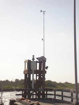
Present tide gauge at Freeport, Texas
Historical Tide Gauge
TIDE GAUGE DATA FROM NOAA TIDES AND CURRENTS

​Operation: National Ocean Service (NOS)
Coordinates: Lat: 28.9483, Lon: -95.3083

6-min Water Level Data
Jan 1, 1996 - Mar 19, 2008

Hourly Water Level Data
Apr 14, 1954 - Apr 30, 1966
Oct 19, 1966 - Oct 6, 1994
Mar 21, 1995 - Mar 19, 2008
​
Picture
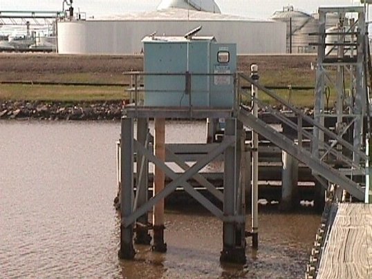
Former tide gauge at Freeport, Texas


​Multi-Media

  • Tropical Storm Bill (2015)
  • Hurricane Ike (2008)
  • Hurricane Carla (1961)
  • Unnamed (1934)
<
>
Picture
Picture
Picture
Picture
Picture
Picture
Powered by Create your own unique website with customizable templates.
  • Home
  • About
  • U.S. Cities
    • U.S. Gulf Coast >
      • Mandeville
    • Florida >
      • Palm Beach >
        • Articles
  • Products
    • Recent Hurricane Data >
      • 2016
      • 2017 >
        • TS Cindy
        • Hurricane Harvey
        • Hurricane Irma
        • Hurricane Nate
      • 2018 >
        • TS Alberto
        • TS Gordon
    • Storm Surge Mapping
    • Real Estate
  • Contact