STORM SURGE NEWS
2022 Atlantic Hurricane Season
Scientific consensus forecasts an active 2022 Atlantic Hurricane Season. U-Surge will be rolling out some exciting new features. Stay tuned for updates!
Stories from the 2020 Atlantic Hurricane Season...
Hurricane Eta to generate 14-17 foot storm surge in Nicaragua
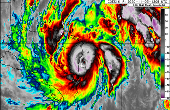
Hurricane Eta slammed Nicaragua with category-4 winds, torrential rain and a massive storm surge on Tue Nov 3. We estimate the storm surge will reach 14-17 feet, which would be the highest in Nicaragua since Hurricane Felix (2007). Read more in this link.
Hurricane Zeta produced a 9-foot storm surge in Coastal Mississippi
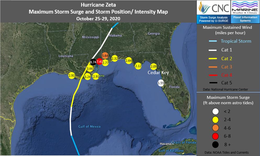
Hurricane Zeta produced a storm surge of approximately 9 feet in Coastal Mississippi. NOAA Tides and Currents gauges around the northern Gulf Coast observed a widespread 2-4 foot surge from South Central Louisiana through Florida's Gulf Coast. Surge levels spiked in Mississippi, where the water level reached 8.74 feet above normal at Bay Waveland Yacht Club near Bay St. Louis, Mississippi, and 7.41 feet above normal in Pascacoula. In Mobile Bay, water levels reached 5.64 feet above normal near the port of Mobile.
Hurricane Sally generated the 4th-highest all-time storm tide level on record in Pensacola, FL
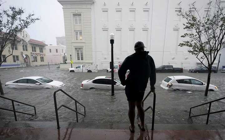
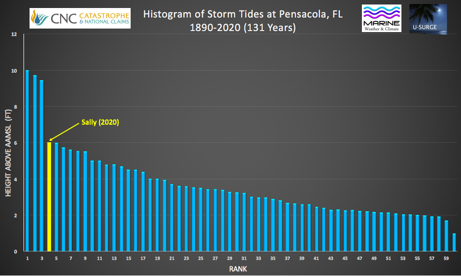
Hurricane Sally rapidly intensified during the 12-18 hours before landfall in South Alabama, enabling it to produce a destructive storm surge that peaked near Orange Beach, Alabama. However, some cities east of the storm track, like Pensacola, Florida, observed a substantial surge that surprised many people. Read about the impacts of Sally's surge on Pensacola in this article published by the Palm Beach Post, that cites U-Surge data. According to U-Surge, Sally's storm tide (storm surge + tide) was the 4th largest on record since 1890.
Storm surge from Hurricane Sally in Pensacola, Florida. Photo: Gerald Herbert/ AP
Sally pushed 6.00 feet of storm tide above Mean Sea Level in Pensacola. This ranks as the 4th largest storm tide on record since 1890. The graphic above is a histogram, ranking storm tides in order from largest to smallest, regardless of the year of occurrence. The top 3 storm tides on record in Pensacola occurred in 1906, 1926 and 2004.
Data-Driven Flood Risk Analysis
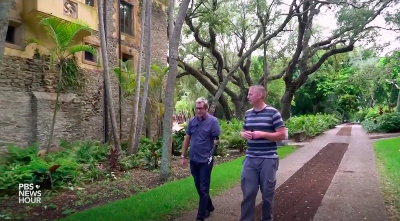
U-Surge provides the first data-driven coastal flood risk analysis for communities from Texas to Maine. Check out this PBS Newshour documentary that features U-Surge and the importance of data-driven flood risk analysis.
Sample City Data
U-Surge provides the following innovations:
- First comprehensive storm surge dataset for coastal cities
- Conversions to a common datum for analysis
- Analytical tools to determine extreme water levels
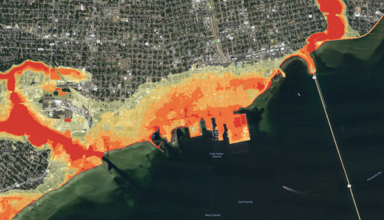
- Mapping tools for spatial analysis of coastal flooding
- Combined storm surge + sea-level rise analysis
- CLICK on the map above to see a sample city (South Padre Island, Texas)
U-surge is continuing to expand through a partnership between CNC Catastrophe and National Claims and Flood Information Systems. CNC provides more than 30 years of unique data obtained from field work following floods. Flood Information Systems keeps the U-Surge database updated and provides spatial analysis of flood risk and impacts through digital map layers.
