Baytown/ Laporte/ Houston Ship Channel

About BaytownComing Soon...
|
Storm Surge HistoryComing Soon...
|
Infographics
Storm Surge Data
Data Sources
TIDE GAUGE DATA FROM NOAA TIDES AND CURRENTS
Tide Gauge Site #1: Battleship Texas State Park, Texas
Operation: National Ocean Service (NOS)
Coordinates: Lat: 29.7567, Lon: -95.09
6-min Water Level Data
Nov 10, 2003 - Sep 13, 2008
Tide Gauge Site #1: Battleship Texas State Park, Texas
Operation: National Ocean Service (NOS)
Coordinates: Lat: 29.7567, Lon: -95.09
6-min Water Level Data
Nov 10, 2003 - Sep 13, 2008

Battleship Texas State Historic Site
Tide Gauge Site #2: Lynchburg Landing, Texas
Operation: National Ocean Service (NOS)
Coordinates: Lat: 29.765, Lon: -95.0783
6-min Water Level Data
Jan 1, 1996 - Dec 31, 1996
Sep 12, 2000 - Feb 5, 2003
Dec 8, 2015 - Present
Hourly Water Level Data
Jan 1, 1996 - Dec 31, 1996
Sep 12, 2000 - Feb 5, 2003
Nov 1, 2011 - Sep 30, 2012
Dec 8, 2015 - Present
NOAA tide gauge at Lynchburg Landing, Texas
Tide Gauge Site #3: Morgan's Point, Texas
Operation: National Ocean Service (NOS)
Coordinates: Lat: 29.6817, Lon: -94.985
6-min Water Level Data
Dec 31, 1995 - Aug 27, 1996
Jan 5, 1997 - Present
Hourly Water Level Data
Mar 17, 1993 - Aug 27, 1996
Jan 5, 1997 - Present
Tide Gauge Site #3: Morgan's Point, Texas
Operation: National Ocean Service (NOS)
Coordinates: Lat: 29.6817, Lon: -94.985
6-min Water Level Data
Dec 31, 1995 - Aug 27, 1996
Jan 5, 1997 - Present
Hourly Water Level Data
Mar 17, 1993 - Aug 27, 1996
Jan 5, 1997 - Present
Multi-Media
Tropical Storm Bill (2015)
Hurricane Ike (2008)
Hurricane Alicia (1983)
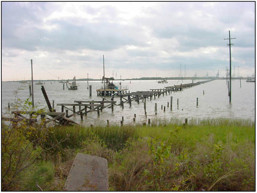
Brownwood subdivision in Baytown was a beautiful place to live, but its vulnerability to coastal flooding was its downfall. Sea-level rise and subsidence enabled salt-water flooding to occur with increasing frequency through the 1960s and 1970s. In 1983, Hurricane Alicia produced a large surge that destroyed much of the area, causing hundreds of homes to be abandoned. Note: Around 1:30-1:40 into the video a man says he moved into a home that he later learned flooded in Carla in 1961.
Hurricane Carla (1961)