U-SURGE
  • Home
  • About
  • U.S. Cities
    • US Atlantic Coast (North) >
      • Rhode Island >
        • Newport
        • Providence
      • Massachusetts >
        • Boston
      • Connecticut >
        • New London/ Groton
      • New Jersey >
        • Cape May
        • Atlantic_City
        • Sandy Hook/ North Jersey
      • New York >
        • New York City
    • U.S. Gulf Coast >
      • Texas >
        • South Padre Island
        • Corpus Christi
      • Mississippi
      • Alabama
      • Florida
  • Contact

Mapping Products

The U-Surge Project offers storm surge mapping products 


​Storm Surge/Storm Tide Maps
Maps available for storms from 1880-2015 

Picture
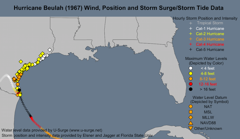
Storm Surge/Storm Tide Maps display the spatial extent of storm surge/ storm tide observations, as well as the hourly track and intensity of the hurricane that generated the coastal flooding event. Available for 300+ storms since 1880.
© 2017 Marine Weather & Climate. All rights reserved.
  • Home
  • About
  • U.S. Cities
    • US Atlantic Coast (North) >
      • Rhode Island >
        • Newport
        • Providence
      • Massachusetts >
        • Boston
      • Connecticut >
        • New London/ Groton
      • New Jersey >
        • Cape May
        • Atlantic_City
        • Sandy Hook/ North Jersey
      • New York >
        • New York City
    • U.S. Gulf Coast >
      • Texas >
        • South Padre Island
        • Corpus Christi
      • Mississippi
      • Alabama
      • Florida
  • Contact